


Geospatial
Knowing our work with public agencies is supported with tax dollars paid by our neighbors, CEM’s Geospatial services focus on providing our clients with the most innovative and practical solutions to their digital data challenges. We understand that most public data regarding land ownership and use still resides in paper format or disparate data sets in different software programs or platforms, resulting in higher than needed costs to manage public infra-structure. We help by designing, creating, and populating centralized and searchable databases with associated easily-read maps and mobile applications.
 Geospatial

 Digital Data Acquisition & Analysis
Project Scope
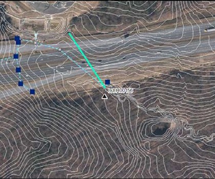
Recognizing the efficiencies that could be obtained by creating a digital database for its inventory of ~5,000 properties requiring inspection and maintenance, the Leasing and Property Office of the Maryland Transportation Authority pioneered the use of Google Earth Enterprise in the State of Maryland to achieve this goal.
Challenge
Maintaining the accuracy of thousands of land records, derived from original source material as diverse as paper plats, written legal descriptions, and outdated digital formats.
Solution
With a strong commitment to document integrity, CEM developed a comprehensive and efficient data processing method that met the data stewardship needs of MDTA, and provided a new digital product that retained the accuracy of each original land record.
Community Impact
Putting all asset management data into a useful digital platform allows MDTA to inspect and repair its myriad of properties associated with Maryland roadways efficiently and economically.
Relationship
The MDTA Right-of-Way Inventory Services project began in 2008 and reach successful completion in 2014.
Responsibility
High ($100,000 < Budget < $1,000,000)
Database Design & Optimization
Project Scope
The Federal Rail Administration is undertaking extensive planning for the rehabilitation of the heavily utilized 457-mile Northeast Corridor (NEC) main rail line, traversing major cities such as Washington, Baltimore, Philadelphia, New York and Boston, due to aging infra-structure.
Challenge
With multiple public agencies contributing data for this planning initiative across such a broad geographic corridor, the volume and diversity of data type, integrity and accuracy was unprecedented.
Solution
CEM inventoried the data types, developed an efficient method of acquiring and verifying the accuracy of the data received to develop a comprehensive database and associated maps in support of the Draft Tier 1 Environmental Impact Statement.
Community Impact
This environmental assessment is the first step in the planning and design process of an improved NEC rail line.
Relationship
CEM assisted the Federal Rail Administration with this public safety project in 2013.
Responsibility
Moderate ($10,000 < Budget < $100,000)
Cartographic Production & Presentation
Project Scope
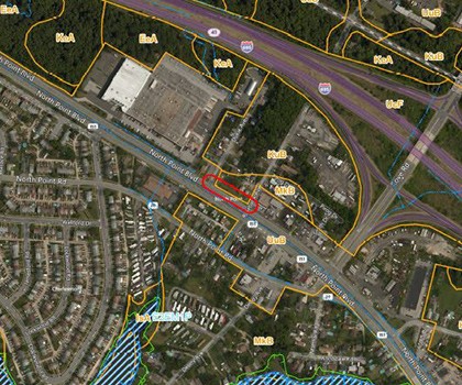
Washington Suburban Sanitation Commission undertook an extensive initiative to repair, replace and rehabilitate its existing sewer collection system under a Consent Decree with the US Environmental Protection Agency and the MD Department of the Environment.
Challenge
The significant geographical area surveyed created a complex and vast digital data collection.
Solution
CEM developed a proprietary document management system to integrate the vast data records, allowing ease of accessibility and interpretation, all while protecting the intellectual property of WSSC in a secure environment.
Community Impact
These sewer system improvements will result in fewer unwanted discharges to local waterways, thus enhancing the protection of both public health and the environment.
Relationship
CEM provided assistance on this project from its inception in 2011 until its conclusion in 2014.
Responsibility
Limited (Budget < $10,000)
Map Books
Data Driven Pages - Maryland Transportation Authority
- Maryland State Highway Administration
- DC Water
- Washington Suburban Sanitation Commission
- City of Baltimore
- Maryland Counties surrounding Baltimore and Washington, D.C.
- Federal Rail Administration